Exploration
We seek conventional gas and geothermal energy solutions that support our long-term business growth and continue to improve our sustainability performance.
Oil and gas exploration
To maximise the value of our gas assets, MinRes has entered into an agreement with Hancock Prospecting (Hancock) on gas and oil assets in the onshore Perth and Carnarvon basins.
Hancock has acquired 100% ownership of Exploration Permits 368 and 426 in the Perth Basin, previously owned by MinRes. Two Joint Venture agreements have been established for the remaining onshore Perth Basin and Carnarvon Basin exploration acreage.
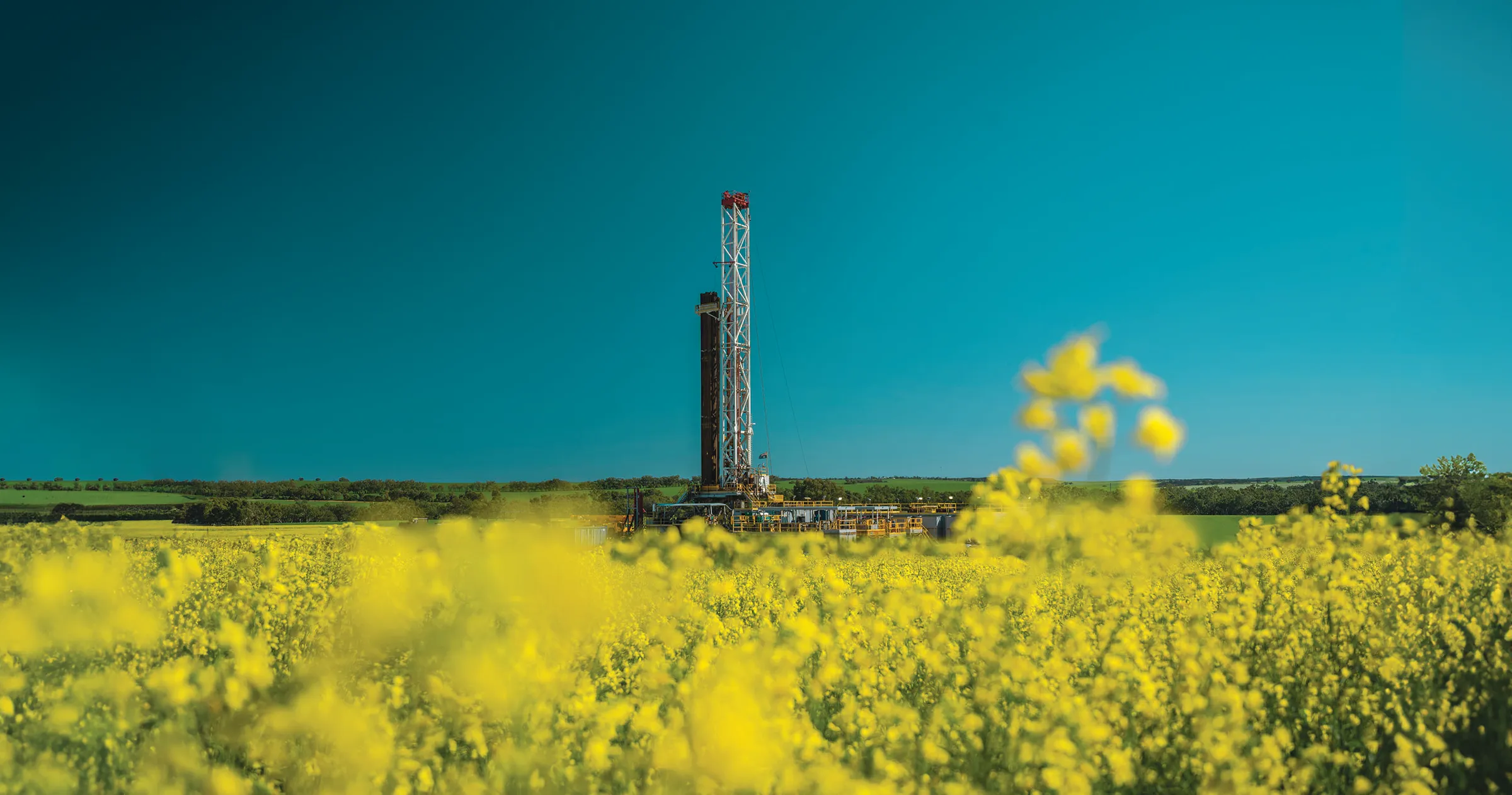
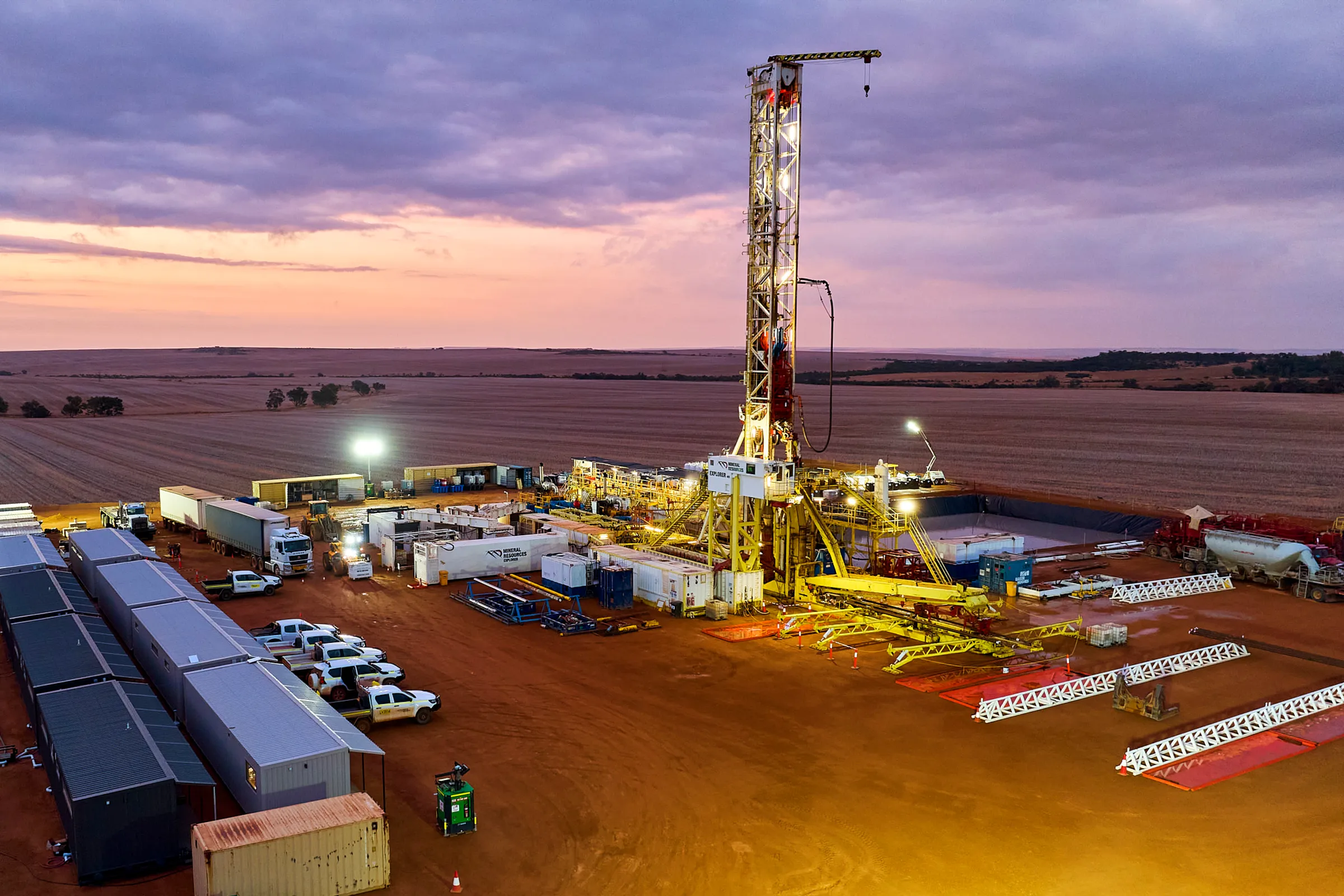
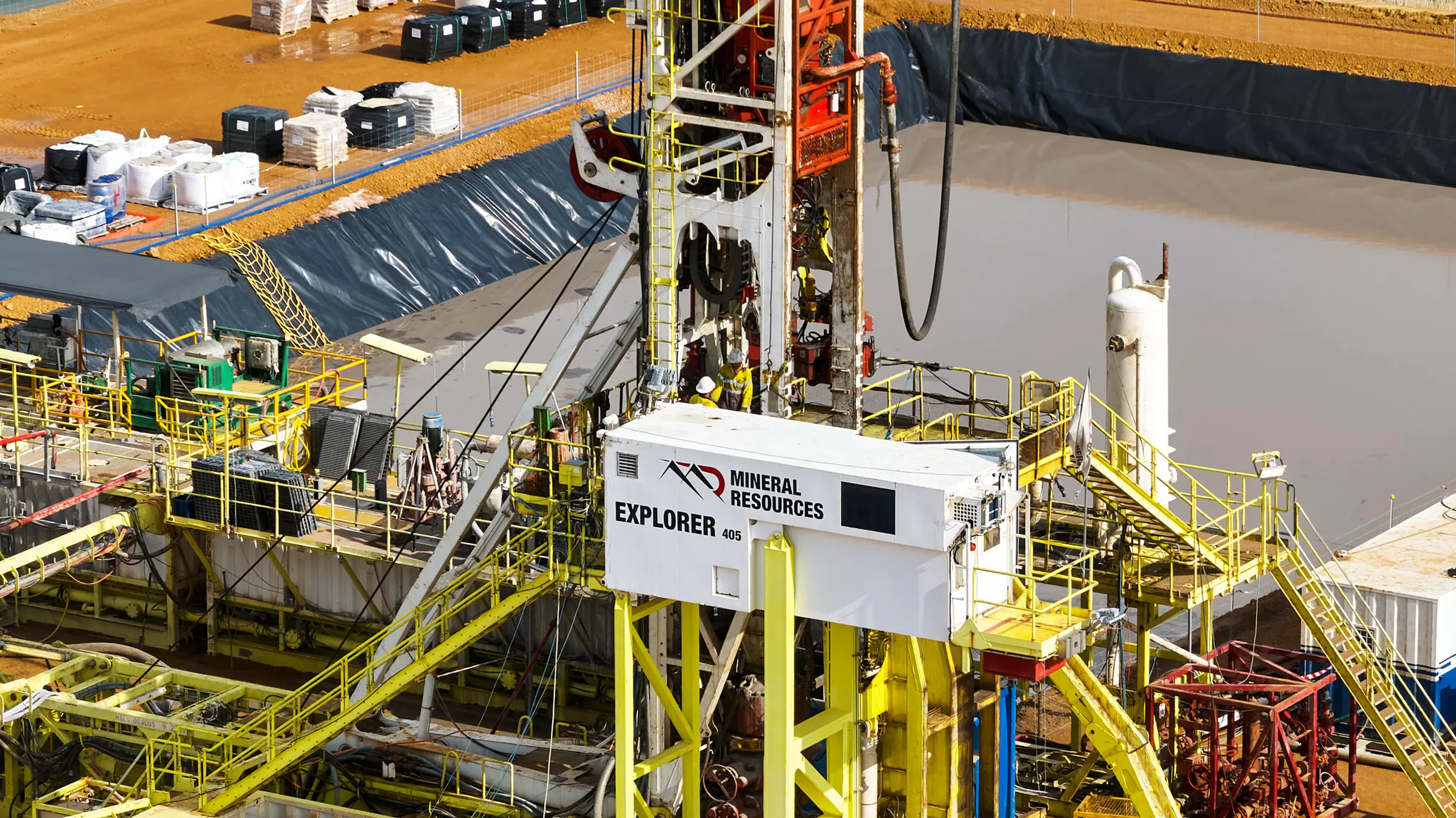
MinRes Explorer
Our automated drill rig, MinRes Explorer, is the largest super single onshore rig in Australia.
MinRes Explorer boasts full automation capabilities, reducing the amount of people that need to be in high-risk areas during drilling.
Through our Joint Venture, Hancock has purchased 50 per cent of the MinRes Explorer drill rig, mobile village, ancillary plant and equipment, while MinRes remains operator.
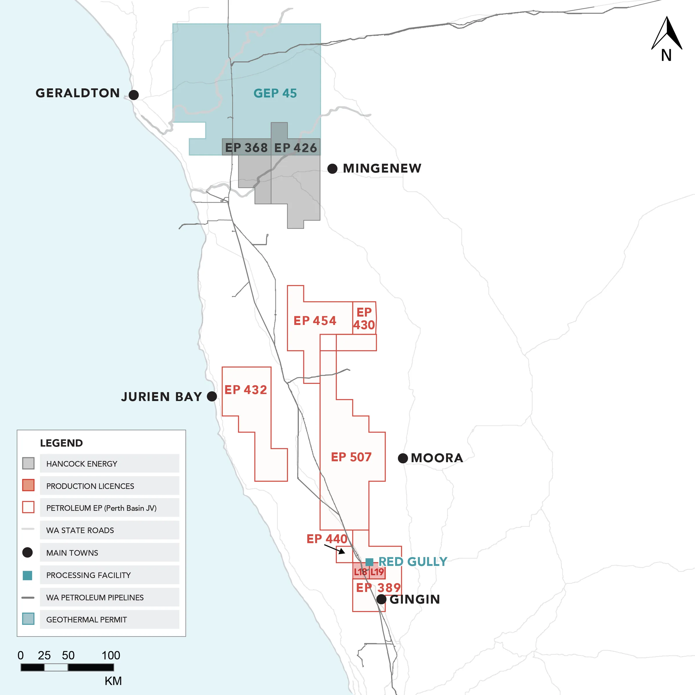
Onshore Perth Basin
In line with our business strategy and to meet the power requirements of our mining and mining services operations, MinRes has strategically acquired gas and exploration assets in the onshore Perth Basin.
We are currently investigating existing and new gas exploration opportunities within the Perth Basin and our new Joint Venture allows us to maintain as aggressive exploration program over the coming years.
We have made significant conventional gas discoveries in the Perth Basin with the Lockyer Deep-1 and North Erregulla Deep-1 discoveries in September 2021 and June 2023, respectively.
In 2024, appraisal drilling at Lockyer-5 further confirmed substantial gas reserves in the region.
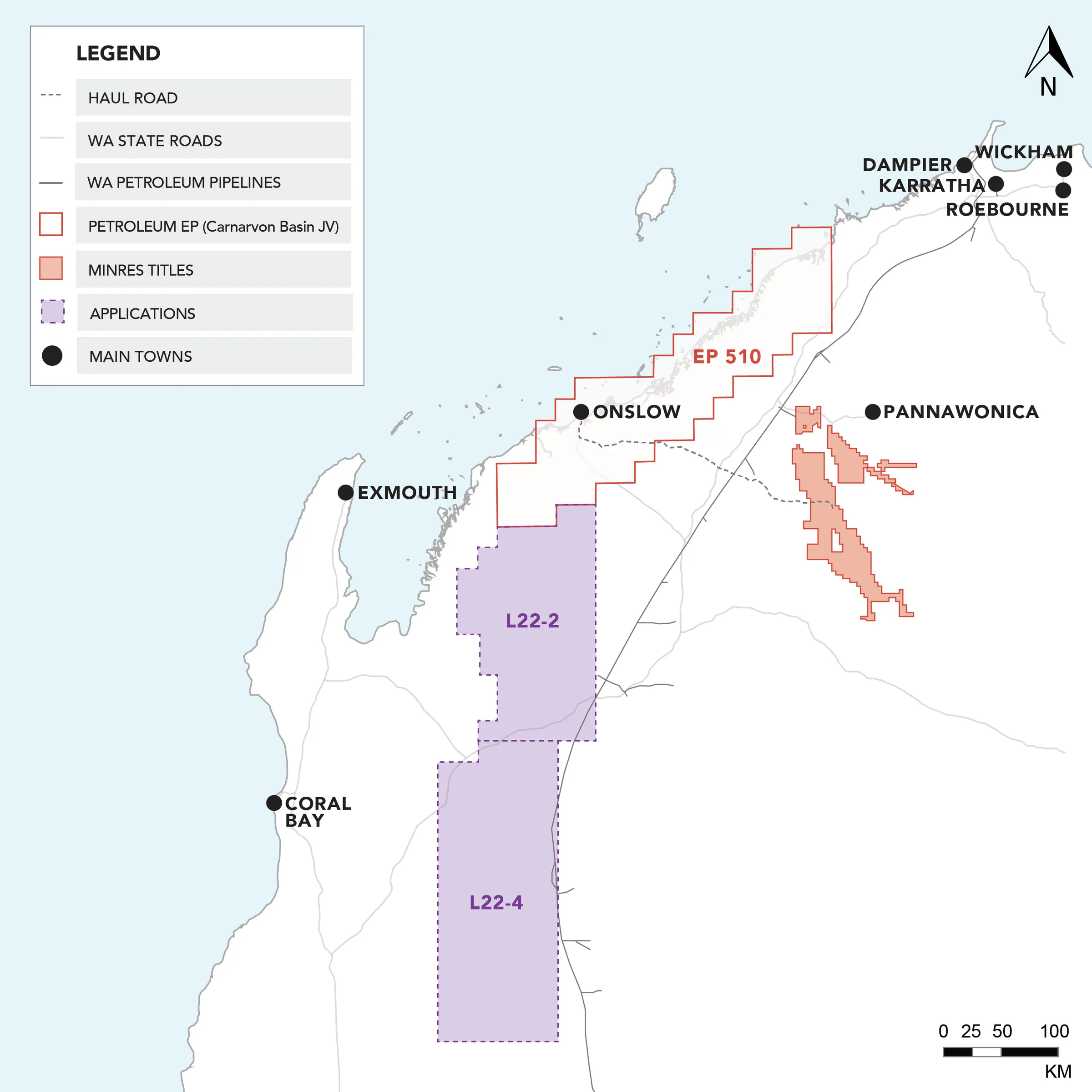
Onshore Carnarvon Basin
MinRes has entered a Joint Venture with Hancock for the Carnarvon Basin exploration permits operated by MinRes.
Near-term objectives include high-priority drilling and 3D seismic surveying, with upcoming seismic and aero surveys which helping us define drill targets.
Three wells are planned for 2025, targeting both conventional gas and prospective geothermal energy sources.
Our engagement approach
Regulations and approvals
MinRes works closely with landowners, government, industry, and community stakeholders to ensure all on ground activities are conducted responsibly, safely and with consideration to the heritage and the environment.
We operate strictly under land access arrangements with traditional owner groups, local pastoralists and private landowners as applicable.
Approvals are always sought and obtained from the relevant shire and government before starting any exploration activities.
Safety, heritage and environment
Prior to any exploration activity, MinRes conducts necessary on ground environmental and heritage surveys, which form the basis of operations management plans, under a strict and well-regulated health and safety management system.
In the Perth Basin, surveying is typically phased with the harvests to minimise disruption to farming and pastoral activities, and compensation is made for any potential disruption that may be caused to landowners’ day-to-day business.
The survey crews also operate under a safety and environment management system that includes an assessment of potential safety and environmental implications of our activities.
Once any on-ground work has been completed, we ensure full and proper rehabilitation is conducted.
Geology and geophysical surveying
Exploration begins by examining local and regional geology to determine the presence and quality of underground reservoirs for potential sources.
Geophysical surveys are acquired to understand the nature of the rocks below the surface. These include the gathering of airborne gravity and magnetics data, and the acquisition of seismic surveys.
Seismic typically uses low energy vibrations from a truck (vibroseis) to image the underground with sound waves which bounce off underground rock formation layers.
The reflected sound waves are then detected and recorded by several microphones (geophones) laid out on the ground at distances up to around 4km away.
This information is used to accurately map the subsurface and target locations for exploration wells.
MinRes has recently safely conducted low impact seismic surveys in the Perth Basin north of Gingin and west of Mingenew, with additional surveys planned for the Perth Basin after the late 2023 harvest.
Drilling
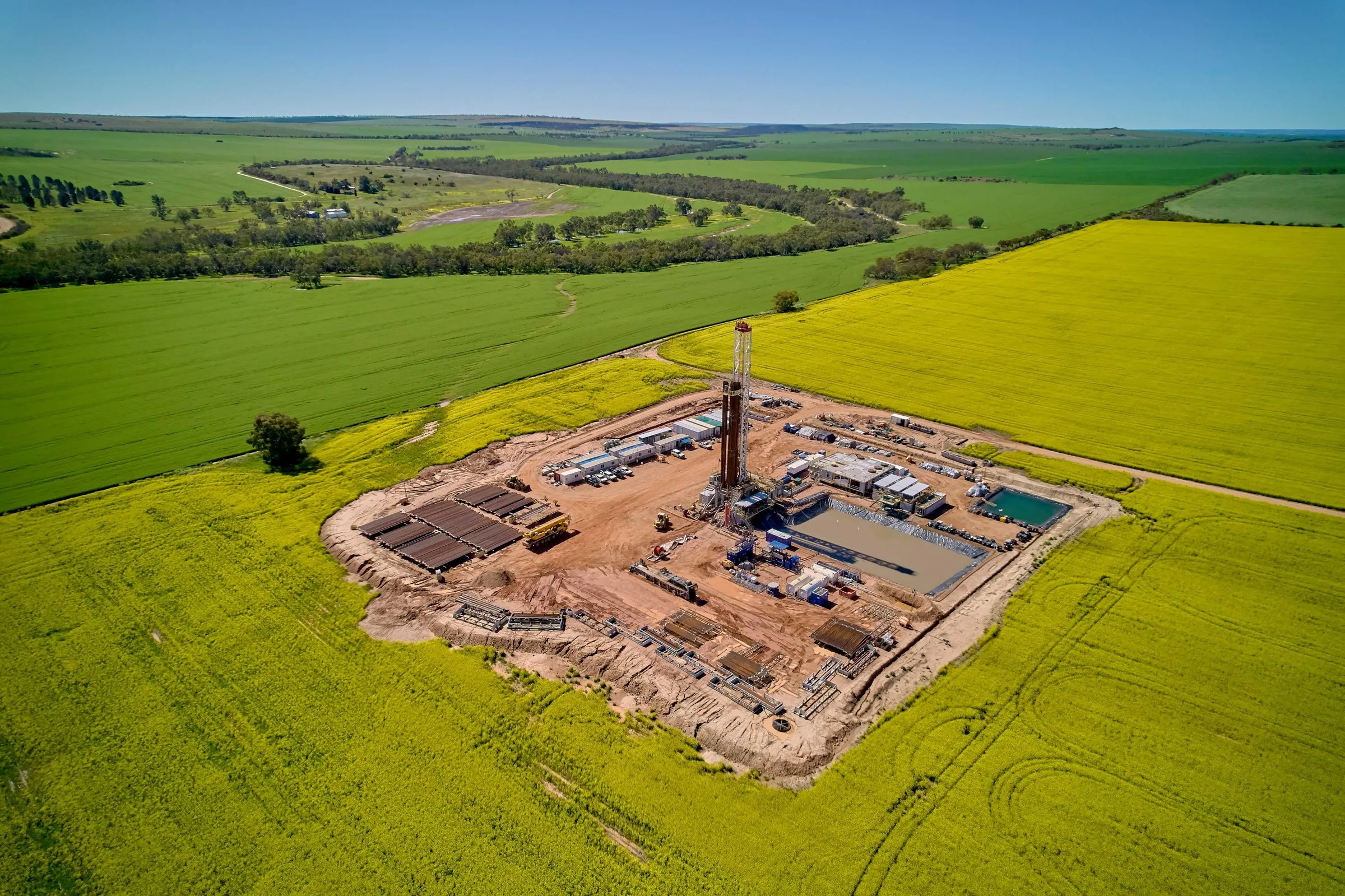
MinRes drilling campaigns involve the selection and preparation of a suitable drilling area and an access track.
Underground well paths are often deviated and steered to the target up to one kilometre away which allows for a rig surface location that minimises the need for land or vegetation clearing.
Once the rig is mobilised to site, drilling operation typically takes around four to six weeks. An evaluation of the rocks is made through examining the samples and lowering specialised electrical logging tools into the wellbore on a cable.
If adequate hydrocarbons or geothermal energy are discovered through exploration drilling, the well may be safely retained for further evaluation and potential production.
In the situation where no resource is found, the hole is safely cemented, the equipment demobilised and the site decommissioned before the area is rehabilitated.